Precision and Professionalism in Every Step of Claim Staking
At Global Geologica, we offer professional claim staking services designed to provide you with efficient way to establish ownership of land or mineral rights. Our skilled team guarantees accuracy at every stage, from claim design to county and federal filings, providing comprehensive support for your exploration and mining projects. With our in-depth knowledge of regulatory requirements and technical expertise, we help you confidently secure and manage your claims, setting a strong foundation for your mining and exploration projects.
What We Offer

Claim Map Design
We provide detailed and accurate claim map designs tailored to your specific project needs. Our team ensures that all necessary boundaries and data are clearly marked to facilitate the claim staking process and comply with regulatory requirements.

Professional Claim Staking
Our expert team ensure that you establish legal ownership of land or mineral rights. From site identification to final documentation, we manage the entire process with the utmost accuracy, helping you secure exclusive rights for exploration and mining activities

Generation of COLs
We generate comprehensive Certificates of Location (COLs) for your mining claims, ensuring that your claims are formally recognized by local and federal authorities. This essential document serves as proof of your claim's status and is crucial for moving forward with exploration and development.
.png)
A generated map showing the geology within the proposed Bear Mountain – Black Smith lode claims.
.png)
This map shows the proposed 6 claims (BB01-BB06) of Bear Mountain Lode Claims filed by Celatus Copper USA Inc.
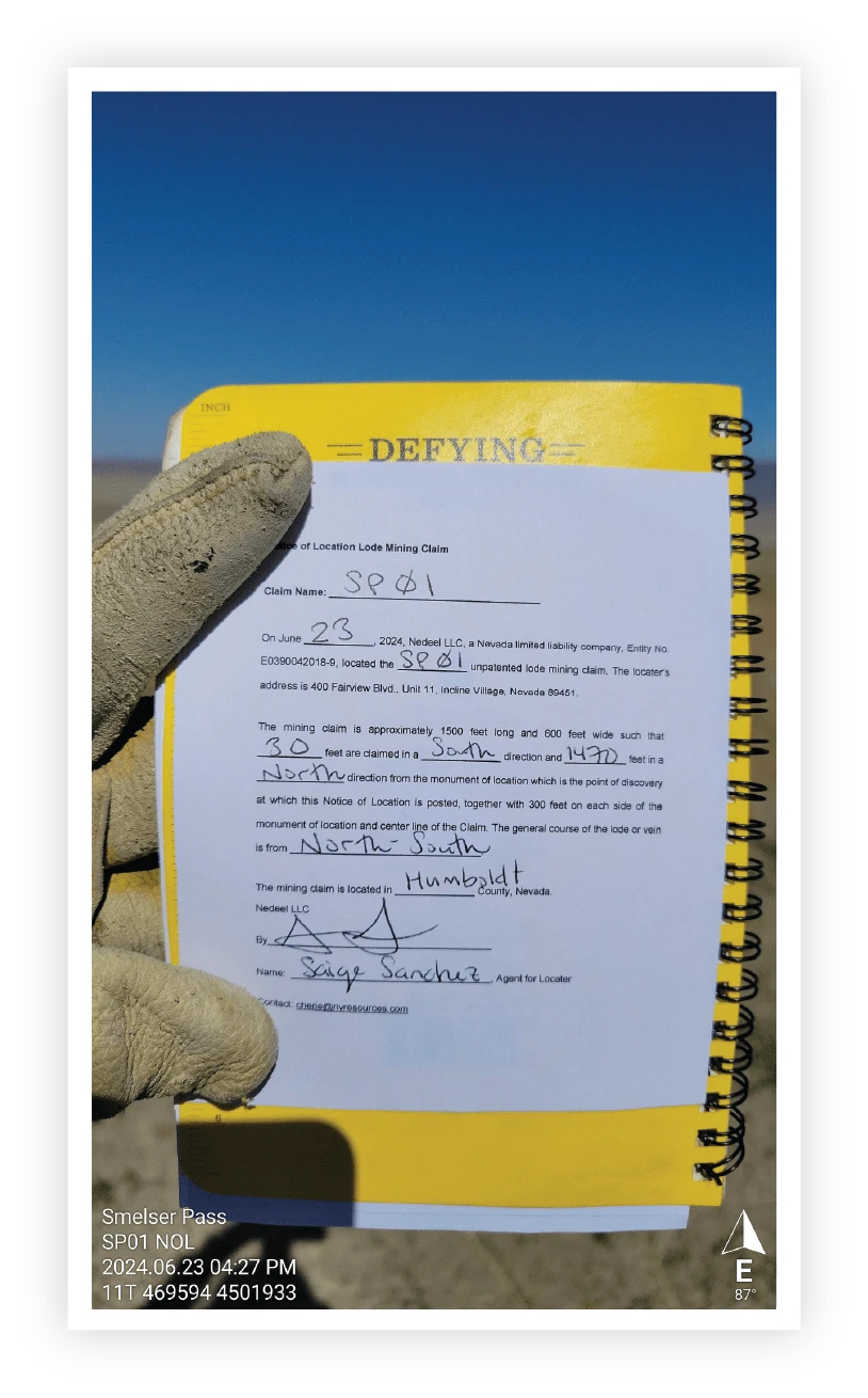

This is an example of a Certificate of Location for Smelsar Pass Claim block #01, which was staked and filed by Global Geologica's field team on behalf of Nevada Limited.
This 1.5' x 1.5' x 5' wood post serves as the marker for Burro Basin's claim block #03, displaying the claim information on its surface.
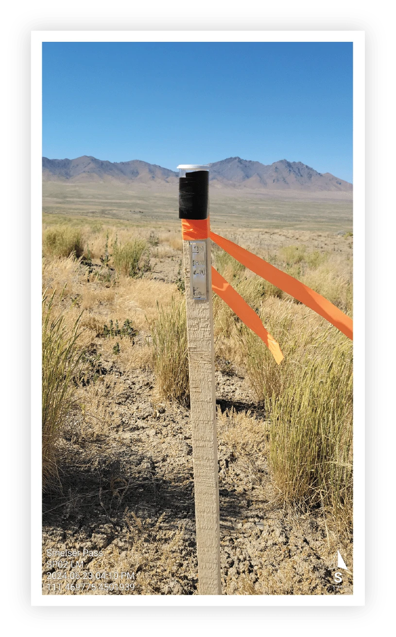
A location Monument of Smelser Pass’ claim block # 02 in the field. The LM is represented by a 1.5’ x 1.5’ x 4’ wood post with the information of the claim sealed in a cup on top of the wood post.